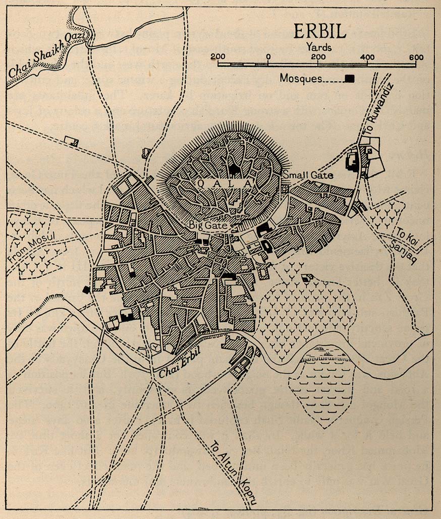
Erbil map from 1944. More old Middle East city maps available from the University of Texas' Perry-Castañeda Library Map Collection. Speed for map nerds.
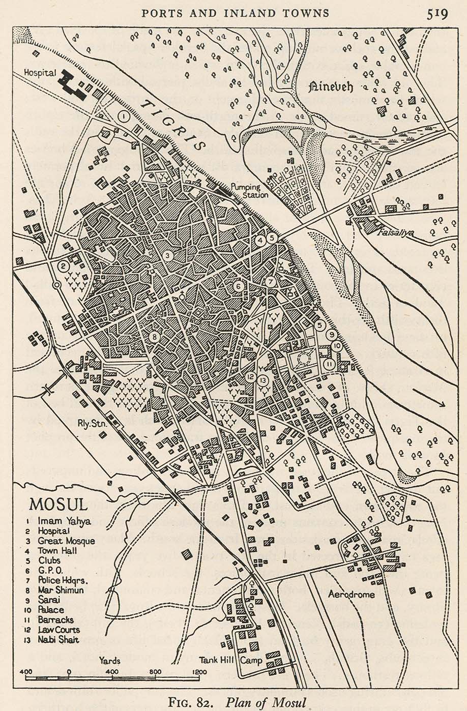
Mosul map, 1944.
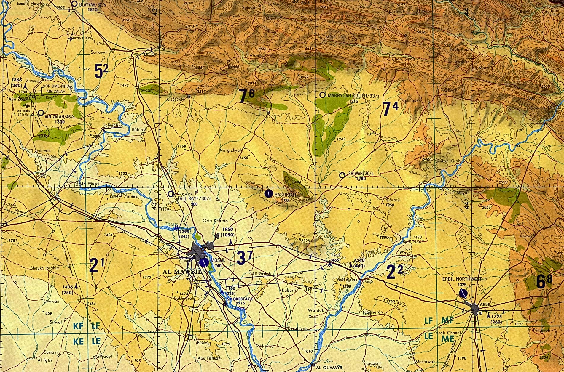
Mosul-Dohuk-Erbil region, "tactical pilotage chart" (not for navigational use), 1989.
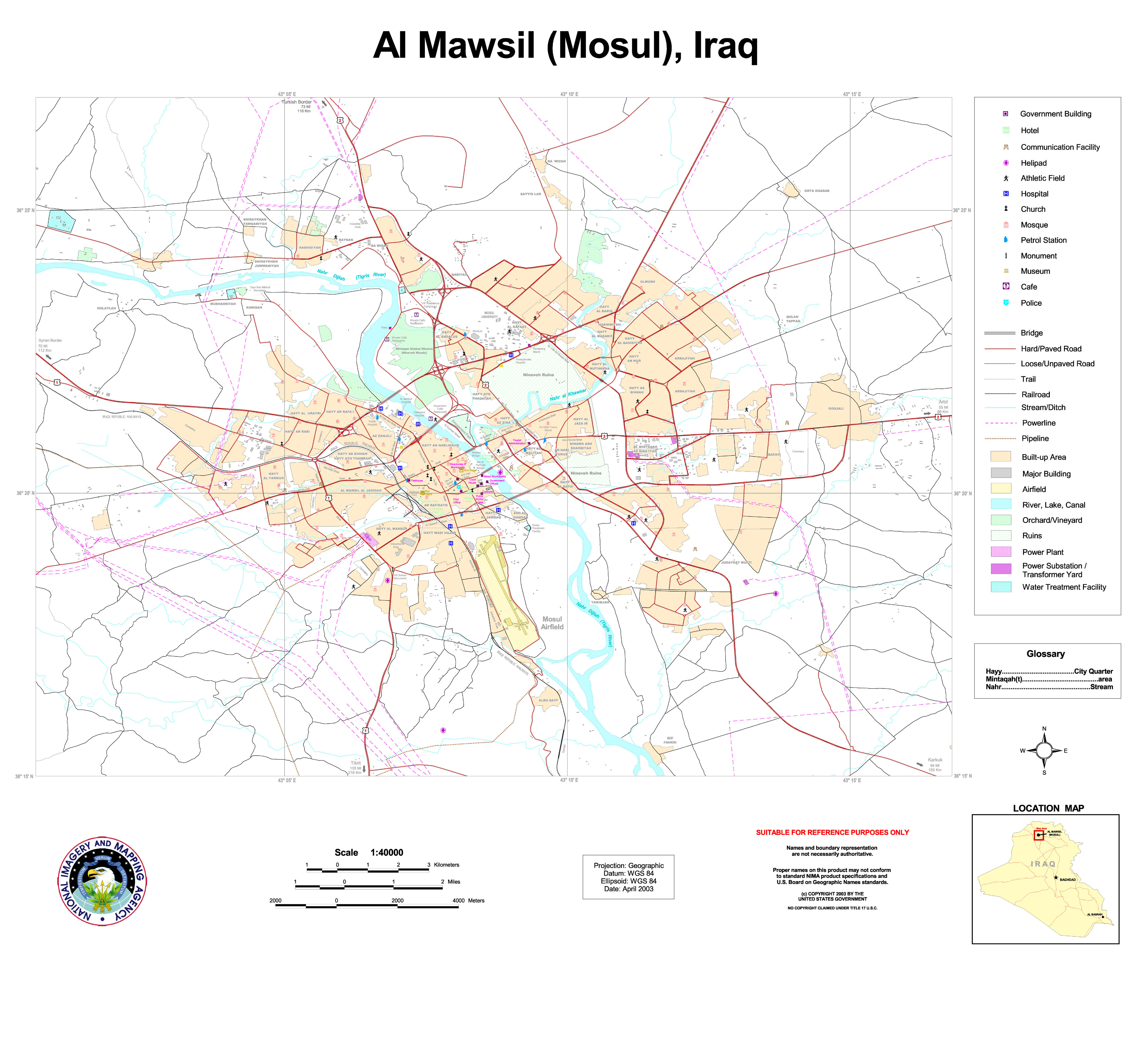
And for those of you crazy enough to want to visit Mosul right now, here is a 2003 map of Mosul:
There are many more fascinating maps on UT's excellent & detailed Iraq Maps page.

No comments:
Post a Comment